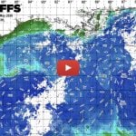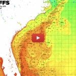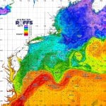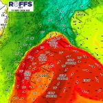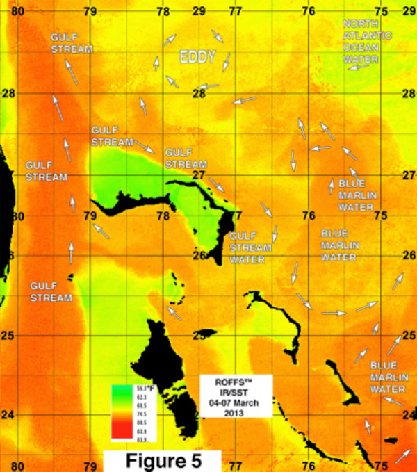
These movies were created by putting together infrared satellite images from the last 30 hours from May 06-07, 2013 from the Bahamas area. The darker the shade of gray (red/orange) the warmer the water temperature. We follow the currents by their signature surface water temperature. These movies shows that the warmest and bluest (from ocean color satellite data) water south and east of Cat Island (east of Andros Island) and right hand bottom corner of the image sequence also is the primary source of blue marlin and yellowfin tuna in the Bahamas. When this water moves northward toward the Abacos Island and then westward to the Gulf Stream (shown in the upper left hand side), then an abundance of blue marlin and yellowfin tuna enter the Gulf Stream. Presently this water is being pulled northeastward and away from Cat Island. However, the water is then being pulled northwestward by a relatively large clockwise rotating eddy. Then another relatively smaller eddy on the southwest side of the bigger eddy is pulling some of the water and fish westward. Some of this blue marlin – yellowfin water and the fish are moving westward toward the Great Abaco Canyon (northeast of Abaco). Then this water is being pulled westward by yet another clockwise eddy and bringing the fish to the filament of Gulf Stream water northwest of Walkers Cay. Some of this water and fish is being pulled into the Gulf Stream while some is being pulled northward by the eddy. If the larger eddy moves westward it will pull the water and fish closer to Abaco and the northern island chain which will facilitate their movement to the Gulf Stream. Once in the Gulf Stream these fish often cross western side which brings the blue marlin, yellowfin tuna and other highly migratory fish like white marlin and mahi into proximity of the coastal zone from Jacksonville Florida to Cape Hatteras, North Carolina. A few weeks ago there was a large pool of this water moving northwestward and fishing action with blue marlin started off Jacksonville, Florida and other areas north. While the present conditions are not providing the maximum number of fish to move this way, there still are likely to be plenty of fish moving westward.
Shipping, Tow, and Rig Move Forecasts
Current and Eddy Forecast Samples