Introduction:
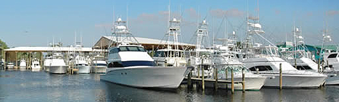
Many people know about the Gulf of Mexico as having the third U.S. coast, the “redneck Riviera,” part of the “American Mediterranean Sea” and from it’s reputation related to good food, music, hurricanes, oil wells, the Deep Water Horizon oil spill, spring break parties, and good ole’ southern comfort. It shares its borders with Mexico and Cuba and has an international mix of all the cultures including the U.S. south, central American, U.S. north and Canada. However, we also know it as a great place for fishing action with blue and white marlin, bluefin tuna, yellowfin tuna, bigeye tuna, wahoo, mahi, sailfish and swordfish (all the highly migratory pelagic species), as well as, snapper, grouper, king mackerel, shrimp, cobia and tarpon. If you have never fished the Gulf of Mexico, you are missing an entire wonderland of world class fishing. I believe that if someone had put a blindfold over your eyes and delivered you to many of the marinas along the coast and then removed the blindfold, you would think that you were in Palm Beach, FL, Fort Lauderdale, Newport Beach, CA, Atlantic Beach, NC, Ocean City, MD or Cape May, NJ. Below shows only part of the Orange Beach (AL) Marina one of the many similar marinas with big fishing boats in the Gulf of Mexico region.
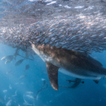
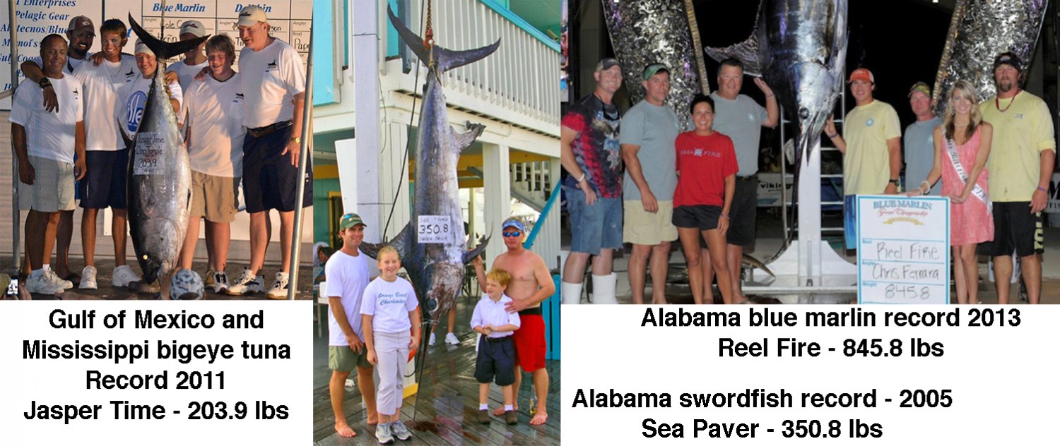
Big fish are also caught in the Gulf of Mexico and below are just a few large fish caught and landed (state records) on rod and reel gear by ROFFS™ clients.
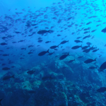
Oceanographically, the Gulf of Mexico is fed by the Yucatan Current that brings Caribbean Sea water northward where the current turns right or loops eastward and then southward to flow through the Straits of Florida between the Florida Keys and Cuba. The Loop Current which is part of the Gulf Stream system is named after this turning. Like other locations where the Gulf Stream Current occurs, the Loop Current is a significant source of dark blue water and highly migratory fish, as well as, many fish eggs and larvae from the south. Other fish like the bluefin tuna enter the Gulf of Mexico as part of their life history to spawn and then migrate out. Others spend much more time there. Like so many other locations around the world, we need a variety of tagging studies to better understand the movements into and out of the Gulf of Mexico. Numerous larvae of many marine species in the Gulf of Mexico and Florida Keys such as “Florida” lobster (spiny crawfish), stone crabs, and probably bonefish migrate northward from Central America and Cuba into the Gulf of Mexico. The Loop Current forms a variety of eddy features and much of the blue water fishing is dependent on the size, location and history of these biologically important vortices. We would be not be providing an adequate description without mentioning that the Mississippi River, the chief river of the largest drainage system in North America, flows into the Gulf of Mexico bringing a tremendous amount of nutrients (probably too many) that contributes to the Gulf’s productivity. The additional productivity stems from the numerous bays and bayous, as well as, from the wind and current generated upwelling. Figure 3 is a false colorized infrared – sea surface temperature image derived for the Gulf of Mexico from U.S. and European satellites over February 15 – 16, 2014.
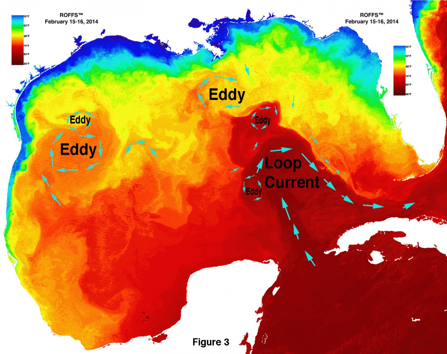
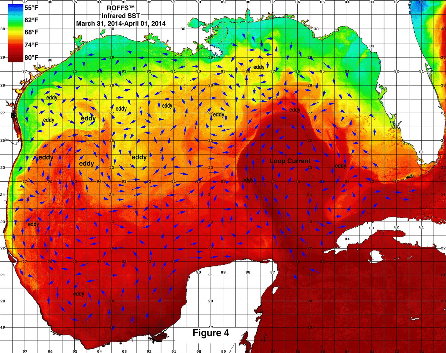
This is provided to show some of the significant ocean features two months ago. Note that although the Loop Current’s northern extension is southwest of Tampa, FL that there are two relatively small clockwise eddy features pulling warmer and blue water to the area south of the Mississippi delta. Note the relatively northwest to southeast orientation of the Loop Current. Also note the relatively larger and warmer eddy east of the U.S. – Mexican border southeast of Brownsville, TX that is pulling warmer blue water from Mexico to the U.S. The conditions should be compared with those shown in Figure 4. another sea surface temperature image (March 31 – April 01, 2014). Note that the Loop Current moved northward and has a more north-south orientation. Relatively warm blue water continued to be pulled northwestward to not only the Louisiana area but also Mississippi, Alabama and even the Florida panhandle favorable for bringing fish toward the cost. The eddy that was off Brownsville, TX is now centered southeast near 96°30’W & 25°00’N and pulling most of the Mexican blue water eastward and southward. A relatively small, counterclockwise eddy (centered near 94°30’W & 26°45’N) is pulling some of the warmer water northward while two other smaller eddies are puling this water toward the Texas coast. This is also favorable for bringing fish to Texas. There is also relatively warm and blue water along the west Florida shelf break indicating favorable conditions as well.
The Forecast Analysis
Figure 5, a infrared – sst image derived from data over April 09 – 11, 2014. We used the same false color palette that we previously used although the Gulf of Mexico is warming and one may not be able to see some of the ocean features in Mexican waters. There was a substantial amount of cloud and other atmospheric interference during this period. The Loop Current moved marginally northward, but is oriented more in north-northwest to south-southeast direction. The water over the Mississippi Canyon area (89°00-90°00’W & 28°30’-00’N) remains relatively warm (72°-73°F) as does the water (71°F-72°F) over the Desoto Canyon (87°00-88°00’W & 29°30-28°30’N). These suggest that the yellowfin tuna, bigeye tuna, and bluefin tuna are over these canyon areas already. We just need the wind to moderate for the fishing action to develop. The eddy south of the Mississippi Canyon (centered near 89°30’W & 26°30’N) and northwest of the Loop Current is pulling more Loop Current water westward and northward suggesting that the already favorable conditions are likely to improve and as 78°F blue water is being pulled westward from the Loop Current we anticipate that the blue and white marlin will be arriving shortly.
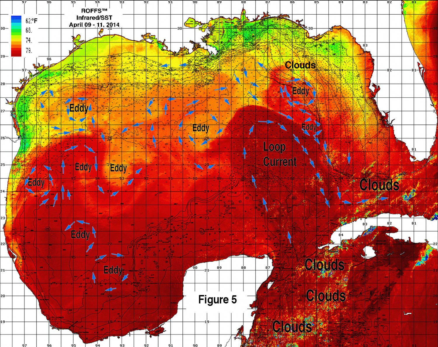
We are observing a substantial pool of relatively warm and blue water over the west Florida continental bringing fish relatively close to the coast already. There is a clockwise eddy west of Tampa centered near 85°30’W & 27°30’N that is pulling more Loop Current water northward. This is creating excellent conditions for marlin, tuna, mahi and swordfish south of the Florida panhandle and as the dominant flow of the water is toward the southeast, we anticipate a good season for the fishermen between the panhandle and the Florida Keys.
The eddy southeast of Brownsville, TX (near 94°30’W & 25°00’N) has remained relatively stationary due, in part to the southwest motion of the eddy east (centered near 94°15’W & 25°00’N) and perhaps due to the eddy south of Brownsville centered near 96°30’W & 24°15’N). We anticipate that this eddy will move northward bringing more warmer and blue water along with marlin, tuna and mahi over Texas waters. The other Texas eddy (centered near 94°45’W & 27°00’N) is likely to pull some of the water and fish northward. These conditions suggest that a good fishing action is likely for boats fishing from Galveston to Brownsville.
Finally the area between Louisiana and Texas (Green Canyon to Flower Gardens Bank and west) does not have as favorable conditions as the other areas now. However, as the water drifts from east to west over the next few months, we anticipate that the conditions will improve. It remains to be seen if the eddy west of the Loop Current will move further north before drifting westward. If it does, then more warmer and blue water will be located further north and improve the conditions south of Timberlier Bay and be in a more favorable location to drift westward over the 100 fathom depths and good bottom structure west.
Bottom Line
The present conditions are very good for most of the Gulf of Mexico. We anticipate that these conditions will improve strongly suggesting that the fishing action this spring and summer will be very good. Also it is very important to realize that good fishing action on a daily basis is strongly linked to local ocean conditions that concentrate the bait fish and larger migratory fish once the preferred habitat of the fish are in a particular region. When the important water mass boundaries are favorable, i.e., persistently pushing over “good” bottom topography, then they concentrate the bait fish. The larger fish can be found concentrated and foraging on the prey. This means that the fishing action on any given day is controlled by relatively short term (hourly to daily) and relatively small scale (1-4 mile) movements of the currents and their water mass boundaries. Our experience indicates that to reliably forecast specific concentrations of fish on a daily basis one must evaluate the ocean conditions on these scales and provide daily updates. Relatively small subtle changes in the conditions usually have dramatic effects on the fishing action. These daily fishing forecasting analyses provide the best chances to find the feeding fish with the least amount of time and fuel.
Get ready to offshore as the winds permit because in many areas the fish are already here. You do not want to be sitting at the dock or worse with your boat in storage when favorable conditions form.
We will continue monitoring these developments as the season progresses and will provide updates.
Safe and Successful Fishing