Northeast U.S. Early Season Preview 2017 FISHING ACTION STARTING TO WARM UP ALREADY WITH LOTS OF FISH EXPECTED IN MAY
By Matthew A. Upton and Mitchell A. Roffer
Please click here to download this article as a PDF.
ROFFS™ concludes its 2017 spring preview series by providing an overall update of the oceanographic conditions from mid-April offshore of the northeastern United States focusing in on the Mid-Atlantic Bight region and its canyons that includes the zone from Cape Hatteras to Georges Bank. We again utilized a combination of many different data sets especially satellite derived sea surface temperature (SST) and ocean color/chlorophyll images. In this article we will discuss the present ocean conditions and what it means for the upcoming late-spring to summer fishing season for the North Carolina to Massachusetts area.
For forecasting short-term oceanographic conditions related to finding fish, ROFFS™ uses real-time direct observations rather than unproven ocean models and longer-term composites. We have learned that evaluating the preseason conditions along with regional, downscaled climate models provides insight into future seasonal trends for fishing. Experience and understanding the ocean – atmospheric dynamics is our guide as we have had moderate success in forecasting seasonal trends of fishing productivity based on the stepwise progression in the location of the fishes’ preferred habitat based on temperature and water color. Please reference our 2017 Bahamas forecast for more in-depth discussion on the environmental and climate indicators that goes into our detailed evaluation of the eastern United States fishing forecasting analysis (Click Here).
Background and Some Observations for 2017
It is important to look at the year-to-year trends including the anomalies to gain insight into the location and condition of the fishes’ preferred habitat compared with previous years. Comparing similar locations and features to last year during the same mid-April time period we found that the SST of the core of the Gulf Stream off of Cape Hatteras, NC for 2016 was approximately 77.6°F- 78.0°F and for this year it is approximately the same if only slightly warmer (78.0°F – 78.5°F). However, we did notice that this year the Gulf Stream was warmer off of Cape Hatteras in mid-to-late March by 1.0°F – 2.0°F compared to last year. This short-term cooling is not surprising due to the recent cooler weather. However, the SST of the coastal water off of Maryland to Virginia is approximately 1.0°F to 1.5°F warmer this year than during the same time period in 2016. These and other indicators that will be described below suggest an earlier arrival of tuna, wahoo, dolphin and even some billfish into the northeast canyon region this year compared to last year.
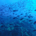
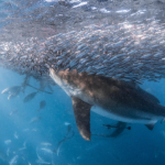
The good news is the substantial volume of Bahamas “blue marlin” water continues to push north of the Bahamas and into the Gulf Stream Current. See ROFFS™ recent Southeast U.S. Gulf Stream fishing conditions analysis (Click here). This water is usually associated with an abundance of yellowfin tuna and marlin along with other highly migratory species. The near continuous connectivity of the Bahamas water to the Gulf Stream this year is a good indication that more fish are continuing to be fed into the northward moving Gulf Stream. We have already have had good yellowfin tuna fishing action off Cape Hatteras, NC, in addition to the excellent yellowfin tuna and marlin season now occurring in the northern Bahamas and eastern side of the Gulf Stream north of Matanilla Shoal. Based on past history we anticipate that these fish will move to the northeast U.S. region in the Gulf Stream and into the relatively large eddy features that move over the canyon areas. Additional good news is that the blackfin tuna (both smaller and larger size classes) along with wahoo are being caught earlier this year on the western side of the Gulf Stream from central Florida to North Carolina compared with 2016.
Nowcast Analysis
One of the most valuable features that we look at when trying to forecast the region in the Northeast U.S. is the number, size and location of clockwise rotating warm-core Gulf Stream eddies that are located north of the Gulf Stream region from south of Georges Bank to offshore of New York, New Jersey to Delaware areas. These are eddies that have broken off from the Gulf Stream and tend to slowly drift westward toward the Hudson Canyon and then in a southwestward direction toward the Norfolk Canyon before being pulled back into the Gulf Stream. The environment associated with warmer blue water and the mixing boundaries of the eddy features provide valuable habitat for the highly migratory large pelagic fish that enter this region yearly.
The spring satellite data shown in Figure 1 and 2, and the fishing reports we have already received may provide insight into the upcoming fishing season. Figure 1 was derived from a variety of U.S. (NOAA and NASA) and European (ESA) satellites to show the SST during the mid-April (April 10-12, 2017) period. Figure 2 was derived from the NASA MODIS ocean color satellites (Aqua and Terra) showing the ocean color/chlorophyll image data during this same period (April 10-12, 2017).
We used a combination of imagery over a few days with the time-tested ROFFS™ cloud reduction algorithm to produce these relatively cloud-free images over this large area. The time of the satellite passes and the amount of data taken from each image is not the same for the SST and ocean color images. Thus, there are some subtle differences in locations of where the water mass boundaries derived from the SST and color occur. A noted mismatch is seen in the area around Cape Hatteras to east of Oregon Inlet where a warmer Gulf Stream filament has pushed north and inshore shown by the SST figure and this filament is actually a mixed blue-green in color, while the ocean color figure shows this water as green. In spite of these and some other issues this image pair is considered more than adequate for the purposes of our seasonal discussion.
The directional flow of the water was derived from our ROFFS™ sequential image analysis techniques, following the water masses, image to image based on the water mass’s distinct, i.e. signature value. An example of this year’s SST satellite infrared imagery in a greytone movie can be found on the ROFFS™ YouTube™ site (https://www.youtube.com/watch?v=FuGD7VYBXsU). Although the data are not in the highest resolution that we use, viewing the movie several times allows one to visualize the flow of the Gulf Stream and other waters. Note that this includes the related warm core rings and other eddies from a larger region during the last month, where the darker greytoned water is the warmer water and white areas are clouds. Figures 1 and 2 below show a smaller area in higher resolution.
[responsive]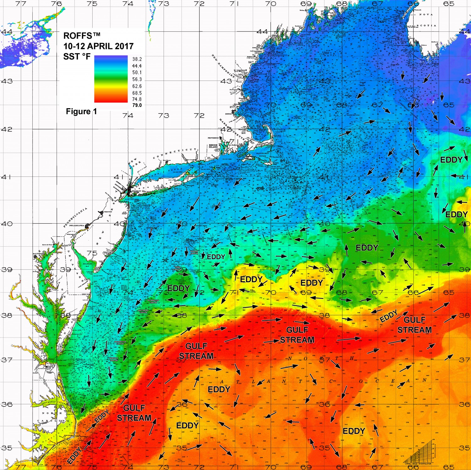 [/responsive]
Figure 1: This year’s Northeast U.S. conditions were derived from a variety of infrared sensors to get SST from NASA, NOAA and ESA satellites during April 10-12, 2017. Main features and surface currents are labeled.
[responsive]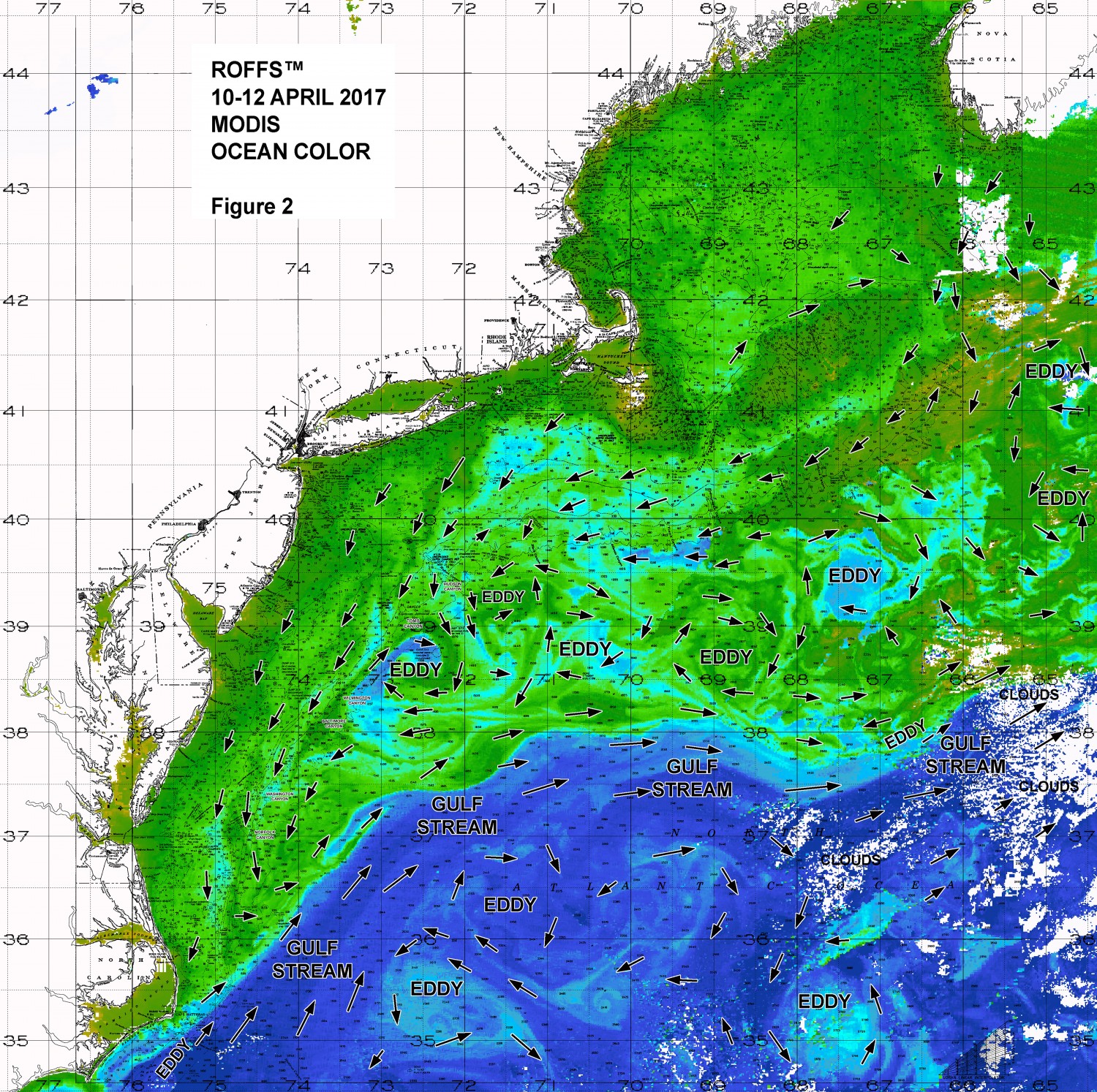 [/responsive]
Figure 2: This year’s Northeast U.S. conditions derived from the ocean color/chlorophyll imagery during April 10-12, 2017 from the Aqua and Terra sensors on the MODIS satellite. We consider this an image pair with the above SST Figure 1 image. Same main features and surface currents labeled, white indicates clouds.
The most promising news is that we continue to observe a series of these clockwise rotating warm core Gulf Stream eddies stacked up north of the Gulf Stream from offshore of Lydonia and Powell Canyons (centered near 67°15’W & 39°30’N), to offshore of Hydrographer Canyon (centered near 68°50’W & 38°45’N), to south of Block Canyon (centered near 70°40’W & 38°45’N) and to areas offshore between Toms Canyon and Spencer Canyon (centered near 72°35’W & 38°35’N). The eddy east of Lindenkohl Canyon is pulling 60°F water directly toward Baltimore Canyon now. These eddies, although still relatively cool, will start to warm relatively rapidly over the next few weeks. As the eddies will be pulling new Gulf Stream water toward the canyon areas, they provide the pathway for the tuna and other migratory fish to enter the canyon areas.
Based on the location of the eddy east of the Lindenkohl Canyon we anticipate an early May tuna season between the Baltimore Canyon and Washington Canyon area. For the eastern canyon areas the Hydrographer Canyon to Atlantis Canyon area looks favorable already and all that needs to happen for the fish to arrive is for the Gulf Stream to meander northward 30-60 miles (as it is already starting to do in some places). Even if this is slow to happen, then the eddy south of Oceanographer Canyon and Lydonia Canyon (centered near 67°15’W & 39°30’N) is likely to provide fish to the Hydrographer Canyon and Veatch Canyon in May. The other eddy pair now south of the area between Block Canyon and Hydrographer Canyon are likely to provide tuna to these canyons in May if the Gulf Stream meanders north or they will provide fish to the Hudson Canyon to Lindenkohl Canyon area in May, June and perhaps July.
From the information shown in the movie on YouTube™ link we noticed a couple of promising oceanographic features way out east. There appears to be another larger Gulf Stream warm core ring forming farther east of Georges Bank that should also drift westward and provide favorable conditions later this summer and early fall. Also, from both this movie and Figures 1 and 2 there are two Gulf Stream related eddies located just east of Georges Bank that are providing relatively warmer water (50°F-56°F) water close to the Georges Bank region and pushing into the Northeast Channel possibly providing an earlier gateway for bluefin tuna into the Gulf of Maine.
Together these conditions are very favorable for a good tuna, marlin, mahi, and wahoo season this summer. We are not concerned about the lack of blue water over this region at this time because we are in the peak season of the spring algae bloom. This is an annual event that provides the food for many of the baitfish species. Note that the Lindenkohl Canyon eddy and the Lydonia Canyon eddy already have plenty of blue water.
Another effective indicator for forecasting a good 2017 season is the recent good fishing reports. These relatively recent fishing reports (first two weeks of April) have already confirmed the good conditions for bluefin tuna action, as well as, for the newly arriving yellowfin tuna, blackfin tuna and mahi along the Gulf Stream edges offshore of Cape Hatteras and Oregon Inlet areas. Furthermore, the bluefin tuna action continues to be good this year off of northern North Carolina and southern Virginia. Without getting involved with a long article on the known and suspected life histories of the different bluefin size classes, these conditions could indicate a better bluefin tuna catch this year for the entire region.
Conclusion
The yellowfin tuna are already here. Based on what we have been observing over the last several weeks from the Bahamas to North Carolina along with the abnormally high number of relatively large Gulf Stream eddy features, it seems that the tuna will be in the canyon areas in May and that a long productive season is very likely. It remains to be seen how many bigeye tuna and albacore tuna will arrive as this is a major mystery over the last few years. We still have so much to learn about the distribution and migrations of these and other fish.
We want you to take advantage of these good early fishing season conditions when the weather permits. So the bottom line is that the existing conditions suggest to us that your boats should already be in the water and you should be in final preparations for your offshore season. Keep in mind that during 2016 and 2017 that some of the best tuna fishing happened late April and during the month of May into early June where the eddies brought the fish in.
It is important to note that good fishing action on a daily basis is strongly linked to local, short-term (days) current conditions that concentrate the fish once the preferred habitats of the fish are in a particular region. When the water mass boundaries associated with these currents are geographically stable and favorable, i.e., persistently pushing over “good” bottom topography and/or in a favorable inshore direction, then they concentrate the baitfish and larger fish can be found foraging. This indicates that the fishing action on any given day is controlled by relatively short-term (hourly to daily) and relatively small-scale (1-5 mile) movements of the currents and their water mass boundaries. Our experience indicates that to reliably forecast specific concentrations of fish on a daily basis one must evaluate the ocean conditions on these scales. Relatively small subtle changes in the currents and their associated water mass boundary zones often have dramatic effects on the distribution and concentration of fish.
Please contact ROFFS™ (800.677.7633 / fish7@roffs.com / roffs.com) for the up-to-date detailed fishing conditions and get the inside track to where the better fishing locations will be tomorrow and next week. We continue to monitor the northeast U.S. oceanographic conditions closely as all it takes is a few days for the Gulf Stream to make a large northward meander and provide early season good tuna conditions directly into some of the canyon regions, so stay tuned to ROFFS™ as the busier fishing season rapidly approaches.
Safe and Successful Fishing