First and foremost our thoughts and prayers continue for all those affected in the Florida Panhandle and throughout the U.S. by Hurricane Michael’s path of destruction. ROFFS™ has analyzed the ocean conditions directly before and after Hurricane Michael’s impact along the Florida Panhandle looking mainly at the eastern Gulf of Mexico using Ocean Color/Chlorophyll (CHL) data. Of note, we used the exact same color palettes for direct comparisons. Hurricane Michael officially made landfall on the afternoon of Oct. 10th.
[responsive]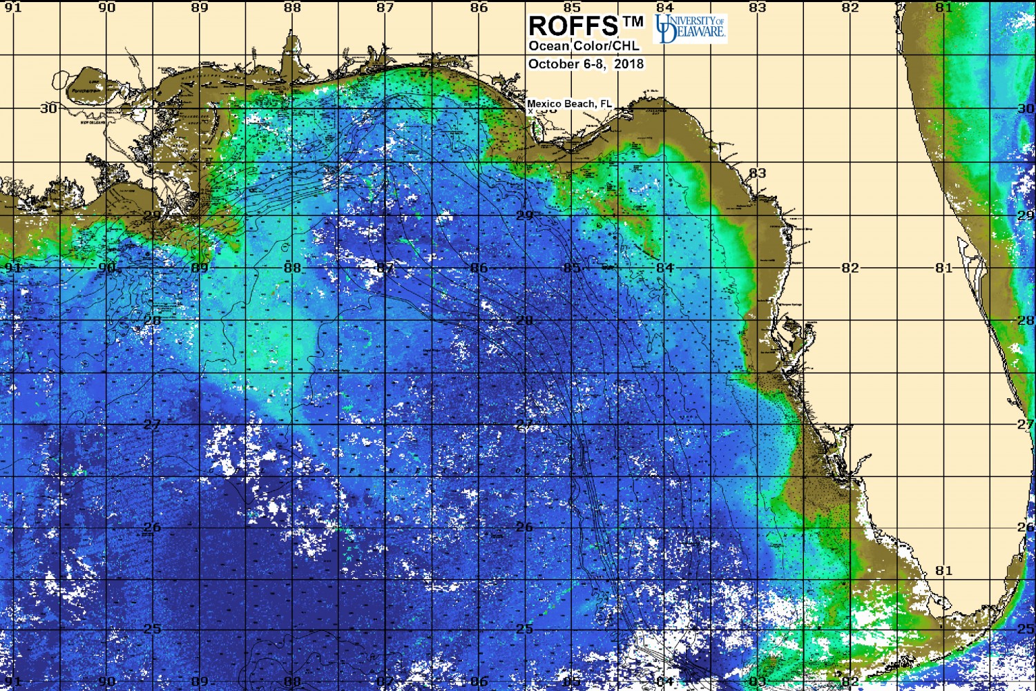 [/responsive]
[responsive]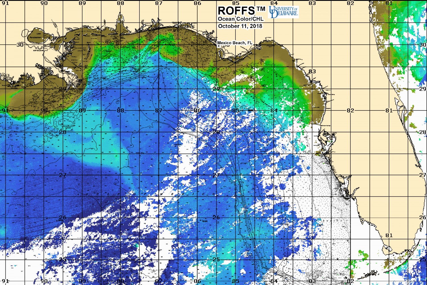 [/responsive]
[responsive]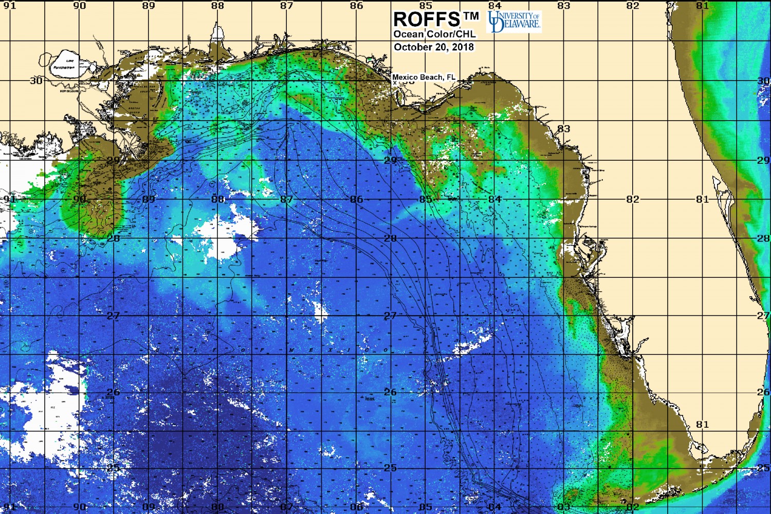 [/responsive]
Looking at the three provided images, one can see a substantial difference in the ocean color/chlorophyll images. The post hurricane images (October 11, 2018 – one day after landfall and October 20, 2018 – ten days after landfall) show the signal of the greener to brown-green more turbid waters near the coast dramatically increased towards the areas of the Florida Panhandle northwestward towards the Florida/Alabama border and also eastward towards the “Big Bend” area of Florida. Please contact ROFFS™ for further information or for tracking the polluted freshwater outflow plumes.