June 4, 2020
ROFFS™ oceanographic fishing forecasting analyses
now powered by Fathom Science™ data
ROFFS™ + Fathom Science™ = No more cloud interference or cloud notes and more accurate forecasts. No one else in the industry can match ROFFS™ analyses and Fathom Science™ cloud-free ocean data.
Fathom Science™ and ROFFS™ are thrilled to bring you their new and improved fish finding service! ROFFS™ now uses Fathom’s data to support their field-proven, time-tested fishing forecasting analyses. You’ll get the same customized fishing analyses from ROFFS™ you’re accustomed to, created from real-time satellite data — now with an always-cloud-free guarantee and an improved forecast for the next day’s fishing!
Fathom Science’s cutting-edge technology adds sea surface temperature and ocean color/chlorophyll data that is always cloud free, ultra-high resolution, and real-time. Using proprietary data analytics and modeling techniques developed in house, Fathom Science’s oceanographers combine satellite data and other real-world observations with ocean dynamics and cloud computing technology to create accurate ocean conditions for today and the next day. Working together, ROFFS™ and Fathom Science™ evaluated and validated the products. The result is the most accurate cloud-free ocean products available anywhere. Now you get even greater accuracy and value from ROFFS™!
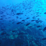
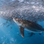
Fathom Science™ is ROFFS™ newest partner in delivering the best available ocean information and providing you the most detailed and reliable fishing forecasting analyses in the world! In the same way that meteorologists produce weather forecasts, Fathom Science™ produces ocean forecasts. Fathom Science uses advanced data analytics and computer modeling to generate high-accuracy, ultra-high resolution (1 km) marine environment intelligence. The product is a three-dimensional analysis of ocean conditions, circulation, and weather that runs continuously, watching the ocean evolve hour-to-hour and day-to-day. Real-world data from satellites, buoys, and other sources are added daily to keep the products accurate and dependable. This lets Fathom Science™ produce cloud-free maps every day and predict tomorrow’s conditions, even when clouds interfere with satellites’ view of the ocean surface.
ROFFS™ combines this new source of ocean intelligence with their decades of experience in producing the most accurate fishing analyses to provide the most comprehensive fish finding analyses in the world. Now there’s more reason than ever to use ROFFS™ to put you in the best position to catch fish! We are extremely excited to offer this elite package during the Big Rock Blue Marlin Tournament as a kickoff for this partnership.
Let ROFFS™ and Fathom Science™ be part of your 2020 fishing team!
Please contact us if you have any questions. Best of luck and stay safe this summer.
Team ROFFS™ /Team Fathom Science™
[/et_pb_text][/et_pb_column][/et_pb_row][et_pb_row _builder_version=”4.4.3″][et_pb_column _builder_version=”4.4.3″ type=”4_4″][et_pb_video _builder_version=”4.4.3″ src=”https://www.youtube.com/watch?v=vnDmmq_TKCo” hover_enabled=”0″][/et_pb_video][/et_pb_column][/et_pb_row][et_pb_row _builder_version=”4.4.3″][et_pb_column type=”4_4″ _builder_version=”4.4.3″][et_pb_text _builder_version=”4.4.3″]ROFFS™ Sample Data – Please click HERE for a FULL sample analysis
Fathom Science™ Sample Data
[/et_pb_text][/et_pb_column][/et_pb_row][et_pb_row column_structure=”1_2,1_2″ _builder_version=”4.4.3″][et_pb_column type=”1_2″ _builder_version=”4.4.3″][et_pb_image src=”https://roffs.com/wp-content/uploads/2020/06/OCCFSampleFSSST.jpg” _builder_version=”4.4.3″][/et_pb_image][/et_pb_column][et_pb_column type=”1_2″ _builder_version=”4.4.3″][et_pb_image src=”https://roffs.com/wp-content/uploads/2020/06/OCCFSampleFSCHL.jpg” _builder_version=”4.4.3″][/et_pb_image][/et_pb_column][/et_pb_row][et_pb_row _builder_version=”4.4.3″][et_pb_column type=”4_4″ _builder_version=”4.4.3″][et_pb_text _builder_version=”4.4.3″]ROFFS™ & Fathom Science™ Frequently Asked Questions
[/et_pb_text][/et_pb_column][/et_pb_row][et_pb_row _builder_version=”4.4.3″][et_pb_column type=”4_4″ _builder_version=”4.4.3″][et_pb_accordion _builder_version=”4.4.3″][et_pb_accordion_item title=”What will the new and improved analysis provide using Fathom Science imagery?” open=”on” _builder_version=”4.4.3″]First off, it is critical to understand that when it is not cloudy or not mostly cloudy, you will always get the same ROFFS™ fully customized analysis from real-time satellite imagery that you are accustomed to using SST images and including a ocean color/chlorophyll image (when available). Nothing is going to be more accurate than using satellite imagery to observe and monitor the ocean conditions, even with a few clouds. As long as we can find the main features, eddies, Gulf Stream edges, Loop Current edges etc.… we will provide the SAME ROFFS™ fishing analysis you are used to.
Now, included on the last two pages of every ROFFS™ analysis PDF (email or download from our website only) will be an additional SST and Ocean Color/Chlorophyll Forecasted Image produced by Fathom Science™. This gives you an idea of what the conditions will look like the morning after you receive the analysis. These images will NOT include the details of ROFFS™ analysis mapping water mass boundaries, SST, ocean color, arrows and hot spot dots. These forecasts will ONLY have on it the bottom structure and grid for reference so you can visualize where the water mass boundaries and features will be based on the color changes. We will use consistent color pallets for the ocean color/chlorophyll images and SST images for direct comparison (i.e. warmer water is reds then oranges to yellows, cooler water is blues and greens, and light green to yellow-green).
When it is cloudy or mostly cloudy, and ROFFS™ cannot see the ocean conditions clear enough to locate the important features (satellites cannot see the ocean conditions through clouds), ROFFS™ analysts will utilize Fathom Science™ cloud-free modeled data to conduct our customized analysis and still also provide the next morning forecasts. This is where the VALUE ADD is to ROFFS™ analysis from Fathom Science™. Hence, no more cloud notes from ROFFS™. Fathom Science™ cloud-free products are the most accurate cloud-free products at high resolution anywhere in the world. We have evaluated and improved their product from our partnership and are confident enough in their data that we feel it is better to send you these cloud-free products as a guide than to send you nothing at all. With this partnership we will continue to improve on the accuracy of their cloud-free products.
[/et_pb_accordion_item][et_pb_accordion_item title=”With now three to four charts to look at, which one should we consider best for guidance? ” _builder_version=”4.4.3″ open=”off”]The most accurate conditions depicting the ocean conditions will be from our regular customized SST analysis (the first image in your PDF product) that we produce from our multiple satellite images. It is IMPORTANT to understand that any cloud-free or modeled product offered anywhere has some limitations and includes modeled components to it and is NOT a perfect representation of the ocean conditions and is never going to be 100% accurate. We decided to partner with Fathom Science because we evaluated many different cloud-free modeled products from many different sources and Fathom Science has the most accurate product that can be utilized to locate the main features and water mass boundaries useful for anglers.
Fathom Science’s cutting-edge technology adds sea surface temperature (SST) and ocean color/chlorophyll oceanographic forecast data that is always cloud free, ultra-high resolution, and up-to-date to our analysis. Using proprietary data analytics and modeling techniques developed in house, Fathom’s oceanographers combine satellite data and other real-world observations with ocean dynamics and cloud computing technology to create accurate ocean conditions for today and the next day. Working together, ROFFS™ and Fathom Science™ evaluated and validated the products. The result is the most accurate cloud-free ocean products available anywhere. Now you get even greater accuracy and value from ROFFS™!
[/et_pb_accordion_item][/et_pb_accordion][/et_pb_column][/et_pb_row][/et_pb_section]