Article Courtesy: saltwatersportsman.com | Originally Published: 3/25/2021 | Click here for original article
Using a Chart Plotter to Control Your Drift
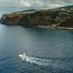
Capt. Billy Harbaugh studied the chart-plotter screen before committing to a second drift. On our initial, fishless pass over the live bottom in 180 feet of water in the Atlantic waters off Islamorada, Florida, the combined current and wind swung the boat wide of prime fish-holding area. Having missed the spot, Harbaugh made note of our drift track on the chart plotter, calculated the proper adjustments, and motored to a new starting point.
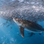
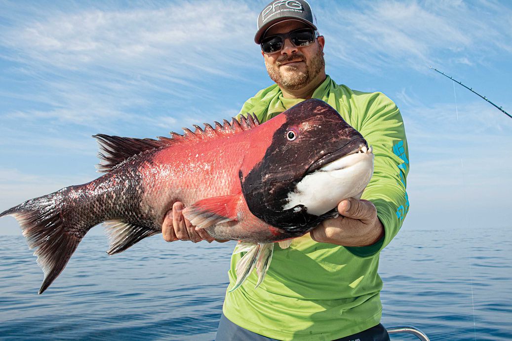
His adjustment made a difference. Within two minutes of our live baits reaching the bottom, Harbaugh hooked up. As he battled the fish, its silvery flanks revealed it was what we were hoping for—a big mutton snapper that had been hunting amid the rubble and soft coral on the seabed.
We went on to catch more big muttons that day, as well as a few nice black grouper, all while drift-fishing.

Successful drift-fishing can be a trial-and-error process, not always as simple as it might seem. Wind and currents that influence drift often converge from different directions and with varying strengths and speeds. At times it is nearly impossible to predict precisely how a boat might drift. This is when skillful use of GPS and chart-plotter functions helps.
By paying attention to waypoints and the track (aka trail) function, you can gain valuable insight on how a boat is drifting at any particular time and location. You then use this information to set up the boat to deliver baits to fish that are likely to bite.
At least one brand of chart plotter now automatically calculates drift heading and speed to give you a starting point based on where you want to fish.
These same techniques apply in all waters, whether you’re drift-fishing a wreck, a seamount, a live-bottom area, sand or mudflats, a FAD, or floating structure such as a weed line, discarded pallet or kelp paddy.
The first step in setting up successful drifts lies in identifying the area you want to fish. If you have fished the spot previously, you might already have it marked on the chart plotter with a waypoint, but if you are fishing it for the first time, set a waypoint or two once the fish finder tells you the boat is over the spot.

Over large wrecks and reefs, the liberal use of waypoints helps visualize the extent of the promising area. The more waypoints, the better the spot takes shape and helps guide you in setting up drifts across different sections of the target structure.

Another useful chart-plotting tool for effective drifts are shaded-relief charts such as BlueChart g3 Vision from Garmin, C-Map Max-N+ from Navico, CMOR and Navionics Platinum+. The relief-shading functions of these charts paint high-profile structure in apparent 3D with color and shadows. With shaded relief, it is not really necessary to lay down a lot of waypoints because the shape, expanse and height of such spots are represented on the chart.

Sometimes you are not focusing on structure, but rather on relatively featureless bottom when targeting species such as flounder or halibut. In these cases, use the waypoint function to mark each bite. By doing so, a pattern or grouping of points may emerge indicating a concentration of fish, and so you can adjust your drift accordingly.
Step two in using a chart plotter for drift-fishing is to activate the track function to display the boat path on the plotter screen after a test drift. This indicates the direction the boat is likely to take on the next drift.
Once you know the drift direction, determine a starting point that will take you on a parallel path that crosses the area you want to fish. Creating a waypoint at the start of the drift helps fine-tune subsequent drifts. For example, if the current is pushing the boat so swiftly that your baits aren’t reaching bottom, you might want to start the next drift farther up-current.
Drifts often change direction or speed during a day of fishing, with shifts in wind direction or velocity, or changes in the tide. With key factors in mind, continually analyze your tracks to ensure that you are fishing the best areas. If you’re not getting any action, you might also adjust the starting point to one side or the other of the original waypoint in order to cover a different area.
Furuno’s new Drift-It technology for NavNet TZtouch3 chart plotters simplifies the process. It calculates the correct starting point for drifting over any particular spot marked on the display. Available in the latest software upgrade from Furuno, Drift-It requires an initial drift distance of about 100 feet to learn the drift direction and speed. It then creates a starting-position waypoint that puts the boat on the best likely drift path.
Predicting a drift pattern can flummox even the most experienced skippers. But advanced GPS and chart plotters make drift-fishing considerably easier and more productive.

The Furuno FA40 AIS (receive only) and FA70 AIS Class B transceiver have multiple ports for plug-and-play connection to a NavNet multifunction display, AIS-capable radar or chart plotter. The FA70 has its own GPS antenna with differential (DGPS) capability. An available signal splitter allows these units to share your VHF antenna, making installation simple. $795 for the FA40, $1,195 for the FA70; furunousa.com

When paired with the ActiveCaptain app, Garmin’s OnDeck remote monitoring system provides critical information via 3G/4G coverage. It watches battery, bilge activity, door/hatch sensors and location. Hardware includes a GTB 10 OnDeck module (with internal GPS), plus door, temperature and shore-power sensors. $849.99 plus one of two subscription plans: $19.99/month or yearly contract at $12.99/month; garmin.com

The Specter system from GOST provides worldwide vessel tracking over the Inmarsat Data Pro satellite constellation. A free app controls and monitors geofences. Specter also allows family and friends to notify the authorities if there is a deviation from the float plan. A new antenna system facilitates communication and provides immediate notification of any boat movement or triggers an audible onboard alarm. $1,299; gost.com